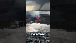
The Most Dangerous Section of the Panama Canal with Actual Construction Photographs from the 1900s
🌎 The Most Difficult Part of the Panama Canal – Culebra Cut (Google Earth Satellite View + Historic Photos)
Deep in the jungles of Panama lies the Culebra Cut, also known as the Gaillard Cut — a narrow artificial valley carved through the Continental Divide. This wasn’t just any stretch of the canal. It was the most dangerous, most ambitious, and most tragic section of the entire Panama Canal project.
In this reel, we take you on a virtual journey using Google Earth, zooming into this historic cut — while overlaying real construction photographs from the early 1900s, when thousands of workers risked everything to dig through solid rock and unstable hillsides.
Here’s what makes Culebra Cut legendary:
• It had to slice through nearly 8 miles of mountainous terrain, including the rugged Culebra Mountain.
• Over 100 million cubic meters of earth and rock were removed by hand, dynamite, and steam shovel.
• Frequent landslides buried entire work crews and machinery, often setting back progress by weeks.
• Temperatures soared, and tropical diseases like malaria and yellow fever took a deadly toll.
• By the time it was completed in 1913, the Culebra Cut had become a symbol of both engineering triumph and human sacrifice.
Even today, navigating this stretch requires care — the walls are narrow, and massive ships must be guided by tugboats. As you’ll see from Street View, it’s a tight squeeze for modern vessels.
📍 Location: Culebra Cut / Gaillard Cut, Panama Canal
📸 Visuals Used: Google Earth, Archival Construction Photos (1904–1914)
🔔 Like uncovering hidden stories with satellite maps and Street View?
Follow for more journeys into lost towns, global landmarks, and unsolved mysteries from above.
#satelliteview #satelliteimagery #googleearth #thestreetviewguy #panamacanal #panama #pacific #atlantic #usa #shipping #internationaltrade #internationalshipping #ships #shipspotting #dangerouswaters
source