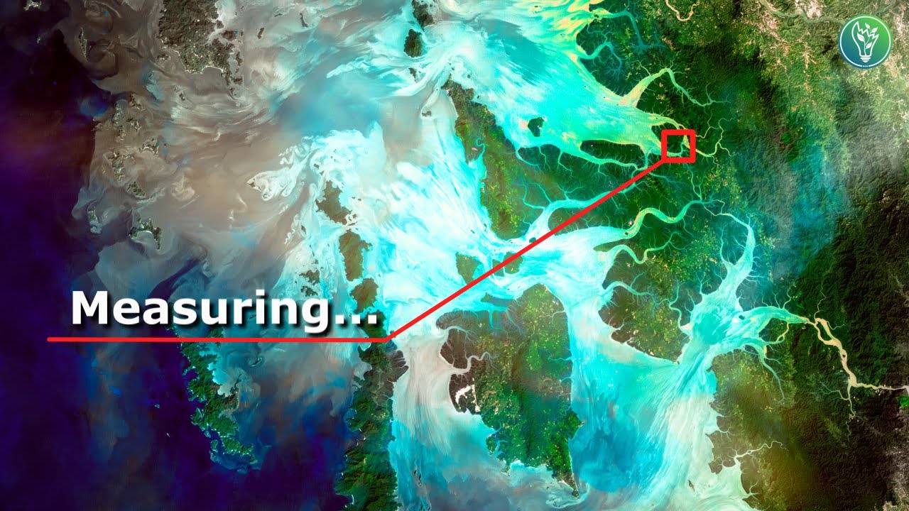
You can’t manage something if you can’t monitor it.
We often discuss sustainable development and climate change, but how do we know climate change exists and how do we monitor it? In this video, we’ll discuss satellite remote sensing, and why it is crucial for monitoring the condition of our planet so we can combat climate change.
Please consider following us on the following media platforms:
Instagram – https://www.instagram.com/oureden_uk/
Twitter – https://twitter.com/oureden_uk?m
Useful links:
Carbon brief: https://www.carbonbrief.org/interactive-satellites-used-monitor-climate-change
Scott Manely’s orbital mechanics: https://www.youtube.com/watch?v=PZAkiXNJIqc
Simon Clark, cold bias: https://www.youtube.com/watch?v=CZQTVvJaJLA
Google Earth Engine: https://earthengine.google.com/
Geospatial World: https://www.youtube.com/user/geospatialmedia
General resources
https://www.nasa.gov/multimedia/videogallery/index.html
https://www.youtube.com/watch?v=EnF_ljgk3gk
https://www.youtube.com/watch?v=xIsUP1Ds5Pg&t=140s
https://www.youtube.com/watch?v=u2bUKEi9It4
http://gis.humboldt.edu/OLM/Courses/GSP_216_Online/lesson1-1/intro-rs.html
https://www.youtube.com/watch?v=e8nPu7T0xKE
Credits:
Adobe stock, Pixabay, Pexels, ZapSplat, YouTube audio library
References:
[1] https://www.universetoday.com/13939/gaia-hypothesis-could-earth-really-be-a-single-organism/
[2] https://climate-adapt.eea.europa.eu/metadata/adaptation-options/use-of-remote-sensing-in-climate-change-adaptation
[3] Guo HD, Zhang L, Zhu LW. Earth observation big data for climate change research. Advances in Climate Change Research. 2015 Jun 1;6(2):108-17.
[4] Wedding LM, Jorgensen S, Lepczyk CA, Friedlander AM. Remote sensing of three‐dimensional coral reef structure enhances predictive modeling of fish assemblages. Remote Sensing in Ecology and Conservation. 2019 Jun;5(2):150-9.
[5] https://tudip.com/blog-post/what-is-remote-sensing-and-its-applications/
[6] https://www.esa.int/Enabling_Support/Space_Transportation/Types_of_orbits
[7] https://en.wikipedia.org/wiki/Moderate_Resolution_Imaging_Spectroradiometer
[8] https://en.wikipedia.org/wiki/Geostationary_orbit
[9] https://www.eumetsat.int/our-satellites/meteosat-series
[10] https://www.eumetsat.int/meteosat-second-generation
[11] Effiong U, Neitzel RL. Assessing the direct occupational and public health impacts of solar radiation management with stratospheric aerosols. Environmental Health. 2016 Dec;15(1):1-9.
[12] Loeb NG, Wielicki BA. SATELLITES AND SATELLITE REMOTE SENSING| Earth’s Radiation Budget, 2015.
[13] Thackeray CW, Hall A. An emergent constraint on future Arctic sea-ice albedo feedback. Nature Climate Change. 2019 Dec;9(12):972-8.
[14] https://www.nasa.gov/content/goddard/2015-arctic-sea-ice-maximum-annual-extent-is-lowest-on-record
[15] https://www.google.com/url?sa=t&rct=j&q=&esrc=s&source=web&cd=&ved=2ahUKEwio0fWenL_vAhWUUBUIHdGyAOUQFjABegQIBRAD&url=https%3A%2F%2Fwww.earthobservations.org%2Fdocuments%2Fpublications%2F201703_geo_eo_for_2030_agenda.pdf&usg=AOvVaw0pz6xj9H9vrwgPhlmQQnbs
[16] Anderson K, Ryan B, Sonntag W, Kavvada A, Friedl L. Earth observation in service of the 2030 Agenda for Sustainable Development. Geo-spatial Information Science. 2017 Apr 3;20(2):77-96.
[17] https://www.spacenewsfeed.com/index.php/news/225-earth-observation-data-services-market-in-2026
00:00 Gaia Theory
00:53 PhD graduates
01:21 What is remote sensing?
03:20 Types of satellite orbits
06:20 Interesting details, often overlooked
07:30 How is this useful for climate action?
08:56 Bonus announcement
09:46 Outro
#OurEden #ClimateChange #RemoteSensing #Satellite
source





Satellite go brr
Are satellites able to measure ocean rise at the scale it’s currently at?
Would love to see a video on SDGs
Dr James Lovelock a NASA scientist, environmentalist and futurist hypothesised that the Earth is like a single giant organism, whose living and non-living components form complex interacting systems that regulate the condition of the planet [1]. This is known as the Gaia theory, and these complex Earth systems determine the state of our environment which has remained largely stable throughout human history and has allowed our society and economy to develop. However, these systems are changing now more than ever, so we need methods of monitoring them, to allow us to make better decisions about how we manage our environment. The only continuous and reliable way of doing this over large areas is by using satellites; this is known as satellite remote sensing. In this video, we are going to explain how satellite remote sensing works and why it is so important for sustainable development and tackling climate change.
But just before we get into it we’d like to apologise for not being very active the last few months. Two of our members were very busy finishing their PhDs. But since they have finished we’ve been working really hard to research and edit a cracking line up of videos. So make sure you subscribe and hit the bell icon to stay up to date.
We also have some really exciting news regarding the next major step in developing OurEden, so watch until the end to find out what it is.
Intro
Broadly speaking, remote sensing is the process of gathering information about something without coming into contact with it [2-3]. For example, taking a photograph with your smartphone. Satellite remote sensing has become increasingly important for mapping, monitoring and understanding the earth’s natural systems, in near real-time at both local and global scales. It’s an extremely powerful tool for assessing information across large geographic areas, like entire forests, continents or oceans, where frequent ground-based measurements would be too expensive or time-consuming [4]. This allows scientists to create data sets that can inform environmental decisions and government policy.
Satellite remote sensing, Passive and Active.
Passive remote sensing measures the radiation that is reflected or emitted by the planet.
Whereas, active sensors emit their own radiation and measure its reflection.
For passive sensors, typically the data we are most interested in is thermal infrared radiation and reflected sunlight. Infrared allows us to measure the temperature of the land, sea and atmosphere, and visible wavelength data allows us to see the surface in real colour. But we can also use these measurements to determine a lot of other useful physical parameters, such as the amount of vegetation, water vapour, soil moisture and much more.
This data is used for a variety of environmental applications, which include; monitoring air quality, detecting flood or drought risk, ocean plastics and deforestation [5]. All these applications are satisfied by monitoring only a few global earth systems
A common example of active remote sensing would be Synthetic Aperture Radar (SAR), which is a complex technique that utilises Radar to detect movements down to a few millimetres from space! We can use this to monitor things like infrastructure integrity, oil spills, deforestation, and urban growth.
To better explain how this data is gathered and processed, we’ll briefly discuss 2 classes of satellite orbits and how they relate to Earth observation, that being polar satellites and geosynchronous satellites.
Polarsats
Most earth observation satellites are in a low earth orbit at an altitude of less than 1000 km (or 620 miles) [6]. This is just above the atmosphere, which would cause drag, and below the inner Van Allen belt which is a high radiation environment, that could damage the spacecraft. These satellites are usually in polar orbits, meaning that they travel between the poles, while the Earth rotates below. Completing one orbit takes around 2 hours, and the satellite continuously acquires images of the Earth along its ground track, known as a swath – which can be stitched together into one continuous image. The swath will eventually cover every inch of the Earth, providing global coverage. The width of the swath determines how long it’ll take to cover the globe, and this depends on the resolution of the instruments onboard.
These instruments are designed to measure particular frequency bands, for example, the Terra satellite’s MODIS instrument measures 36 different bands of light, including visible – red, green, blue as well as many different infrared bands. It has a swath over 2 km wide, with resolutions of 250 m to 1000 m per pixel [7]. With this swath width, the Modis satellite generates an image of the earth Earth almost every day
Each band provides unique information and combinations of bands can be used for calculating things like, land surface temperature or cloud properties and of course generating colour images. This data is incredibly useful for monitoring things like flooding, phytoplankton blooms, wildfires and deforestation.
Geosats
Geostationary and geosynchronous orbits are very different from polar orbits. They orbit much further away, at about 36,000 km [8], and this distance is deliberately chosen so that the satellite orbits the Earth at the same rate that the Earth rotates. This means that geo-sats are always directly above the same spot on the Earth. It also means that their ground receivers can stay fixed, pointing at the satellite's position in the sky; much like how a tv satellite dish works. the disadvantage is that it will never see the other side of the planet.
A good example of a geo-sat is Meteosat-10 which sits directly above Africa and Europe and captures data every 15 minutes. [9]
The two main instruments on Meteosat are Seviri and GERB. Seviri is a meteorological instrument used to monitor things like temperature and clouds. This is very useful for forecasting the weather in Europe and Africa. GERB measures how much of the sun's radiation is reflected and absorbed by the Earth [10,11].
This is very important for climate studies as the more radiation is absorbed by the Earth’s surface, the more the Earth’s oceans and atmosphere will heat up [12]. Over the years, instruments like these have made some crucial discoveries in climate science like, how important polar ice is for reflecting away excess solar radiation [13].
So there are several satellites orbiting the earth constantly acquiring data, but how is that swath data converted into images we can use? Well, the simple answer is a lot of image processing. Firstly, the swath data from different satellite passes need to be stitched together to form a mosaic of the area of interest. Secondly, if we want images showing the Earth’s surface we have to take them when there are no clouds, and this may require many satellite passes over the same location before enough cloudless data is gathered.
Wide swath instruments cover a large area so we can generate cloudless images very quickly, typically, in about 1 week. But higher-resolution instruments have narrower swaths, so getting complete high-resolution mosaics of the Earth’s surface can take up to a month. You can use Carbon Breif’s interactive infographic to see different satellites and what they are used for.
The Earth is changing in ways that will affect our lives, so we need to maintain ways of understanding how and why these changes are occurring, and how we can/be prepared to adapt to them [14]. Satellite remote sensing is the technique for gathering this data, and it does so: frequently, continuously and over large areas. However, simply gathering data doesn’t stop climate change – to do that we need effective and global action, and that’s where the data comes in. Governments and organisations can use remotely sensed data to make more informed decisions and develop more effective plans for environmental action on a national or international level. They can also use remote sensing to measure the impact of their policies – and this is actually a rapidly growing area of interest. This is because satellite remote sensing has been identified as a vital technique for monitoring our progress towards the sustainable development goals [15]. The SDG’s, established by the UN in 2015, comprise 17 goals and 169 targets which have been adopted by world leaders as universal calls to action to end poverty, protect the planet and ensure that all people enjoy peace and prosperity by 2030. This agenda stressed the importance of satellite Earth observation data in informing the targets and monitoring their progress [16].
This is spurring on rapid growth in the remote sensing industry. From 2007 to 2016 there were 181 non-meteorological Earth observation satellites launched and by 2026 it’s estimated we will have over 600 large Earth observation satellites, and countless small ones, monitoring and evaluating the environment [17]. Click the link in the description to find out more about the SDGs and let us know if you’d like us to make a video about them.
If you’d like to know more about remote sensing and how satellites can sometimes get their measurements wrong, you should check out Simon Clarks video on the cold-bias. Also Scott Manley has a great video discussing satellite orbital mechanics in much more detail than we have here.
And if you’re really keen and would like to try your hand at analysing some of the petabytes of free satellite data, that’s been collected over the decades, then have a look at google earth engine; you’ll need to do a bit of coding, but it's actually not too complicated and well worth the effort.
Thanks for watching this OurEden video, please like, comment and subscribe if you enjoyed it, and as always,
Look after yourselves, each other and most importantly the planet around you. Thanks again OurEden.
Nice video, I will also check out some more of your videos!
Edit: I would love to see a video by y'all about the SDG's! This would be a very effective way to spread the idea and some more details about it. Sustainable Development is the (most convenient) future.
Thank you very much for this video and its insights. Currently I've been thinking about making my Bachelor's thesis on remote sensing.
I'm jealous! I'm about to get a masters in GIS & Remote Sensing and I speak Spanish natively and I have translation experience. Can I come work for you too? 🙂
this was a fascinating video! I'm studying remote sensing right now, and it's honestly really neat
wow great video, don't understand why you wouldn't have more views!